Since 28 May 2019 you can access and use some new features. Here’s a brief overview:
-
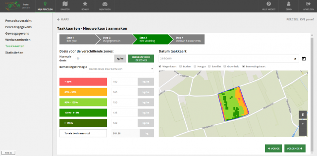
Variable rate fertilization maps
You can now also use WatchITgrow to create variable rate fertilization maps. After submitting your fertilizer product as well as the normal dose that you would apply for your field, you receive a calculation for the dose per zone. To determine the zones, WatchITgrow uses satellite data. You can download the result as a shape file - Continuous crop monitoring and more accurate growth curves thanks to CropSAR
WatchITgrow now uses the new CropSAR technology. This unique technology allows you to monitor your fields even during cloudy days. More information on CropSAR can be found here.
-
New data layers / information maps
Via ‘Global Maps’ you can now also access additional satellite data, soil maps and elevation maps. -
An improved overview of the status of your fields
Via ‘My Fields’ you can rank your fields according to their greenness. This way you can easily see which fields are doing well or less well. -
Store your field data
Via the field dashboard you can now also add:
- A mix of products you used for crop protection or fertilization
- Information about field preparation -
Warnings for fast leaf growth
Receive warnings for fast leaf growth and know when your crop is most vulnerable.
Discover these new features now via your personal WatchITgrow account.
Do you have any questions or need some help? Don’t hesitate to contact us. Our team is happy to assist you!


